This rock face sits on the north end of a hill that peaks as Solberg Butte, but since I have a friend who’s a Solberg I decided that the name applies to the entire hill. I’ve spent some time on this hill from time to time, with the landowner’s permission, and am finally going to tell you a little bit about it while guiding you through last Friday’s hike.
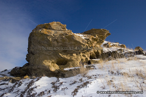
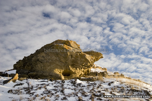
The picture above is the rock face on the north end of the hill, which is the feature that led me to this place. A friend of mine used to fly his hang glider off the back of this hill. On one occasion, the friend who was
filming his crashes helping him came around the corner and exclaimed that he’d found all sorts of writing on the rocks! It was those rocks I set out to find, and find them I did.
I was not wearing the shoes for this. Hiking this hill is fun when it’s not caked in slippery snow, but trudging up it in ankle socks and a pair of well-worn Airwalks is just plain ridiculous. Thankfully I had my monopod with me, which doubles as a hiking stick.
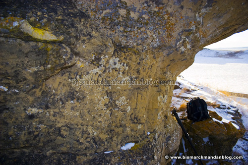
Here’s one of the rock faces filled with writing. I know, there’s so much other gunk on the rock that you can’t make out the writing, but I wanted to show you the cool overhang formed by the eroded sandstone.
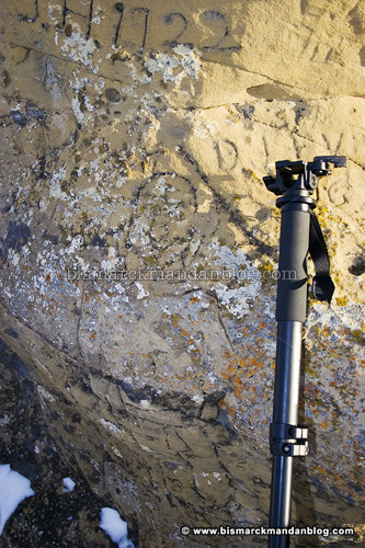
Here we have some of the writings, most with dates. The one at the top of the frame says “J.H. 1922” and below it is the outline of a smilin’ dude. It’s hard to make out, but the top of his head starts just to the left of the top of my monopod.
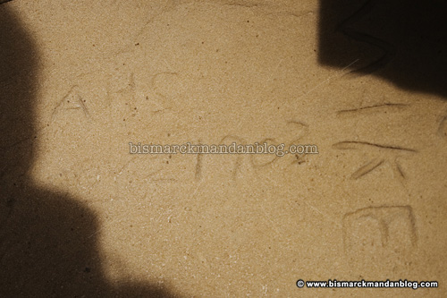
This one was really well worn. It’s dated 1903. I embellished the date just a bit in Photoshop so it would be easier to read. In person it was quite easy to make out. Because this rock erodes so easily, newer carvings like the “MIKE” to the right of it are much deeper.

This particular carving says June (something) 1927. No embellishment here. There are many other carvings as well, but to do so here would require hundreds of photos; the entire rock face has carvings on it!

Surprise of a lifetime: out walking around atop the technically accurate peak of Solberg Butte, I stumbled upon this marker! If I’d been looking for the thing, I’d likely have gone years without finding it. But in the fashion of my usual dumb luck, I nearly tripped on it. This marker (and its accompanying azimuth marker a few yards away) was placed in 1945. You can read more about the National Geodetic Survey’s current incarnation by
clicking here. Its history is even more fascinating; I’ll let you track that down on your own.
 ADDED:
This is the second marker, the one I referred to as an azimuth marker earlier. Notice that the center of the disc has an arrow in it, not a triangle. Bruce, one of my readers, found the actual azimuth marker’s location to be quite some distance away. I guess this one is just to indicate the direction in which the azimuth marker lies. See, I learn something new every day!
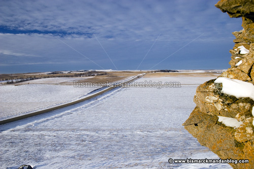
The view of the road. I don’t know if the picture conveys it, but I’m up a little ways.

Cool snow, huh? This was on the hike back down. I had a racquetball date to keep with my wife, and boy did I get
skunked! But overall the day was a success, because I had a fun hike and photos to share. I got to leave work early today due to some extra time I’d put in earlier in the week, so I had time to go pokin’ around.
I’m not divulging the exact location of this site, but I will say that it’s northeast of Bismarck. The geodetic marker is a clue, that it’s in the Naughton township…east of the Naughton School, by the way. But because this land is posted No Trespassing, don’t go getting any ideas. I have explicit permission from the landowner himself to visit this site, something that took quite a while to get. In all the photos I post here, I always honor No Trespassing and other posted signs, respect landowners’ rights, and seek their permission. I expect my readers to do the same.