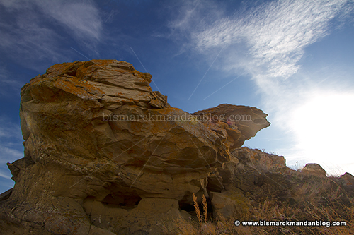
Recently I took a return trip, with the landowner’s permission, to Solberg Butte. As its name suggests, it’s a parcel of high ground that sits near Bismarck, and it’s got a couple of very unique features. I had a window of one afternoon before cattle returned to this land, and I presume the electric fence was turned back on, so I had to make it count…starting with the fascinating features in the rocks you see above.
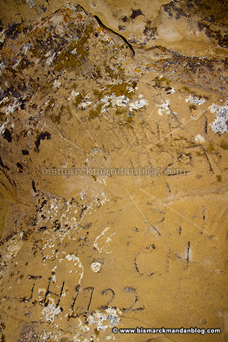
In addition to being a neat little overhang and shelter from the elements, this area also boasts some interesting carvings. As you can see, many of them date back to the early 1900s. The sandstone has weathered over time, so many of them have been obscured…but several remain with their dates abundantly clear.
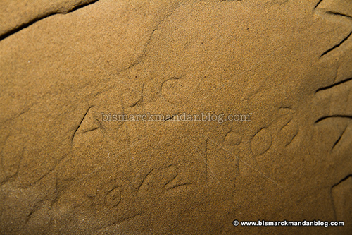
I imagine this area was even more remote in 1903 than it is today; with our statehood beginning in 1889, this carving took place with North Dakota itself was only around fourteen years old! It isn’t exactly
cuneiform, but it does give one a little bit of perspective. But there’s another interesting feature of this butte that I hadn’t expected when I first stumbled upon it (literally):
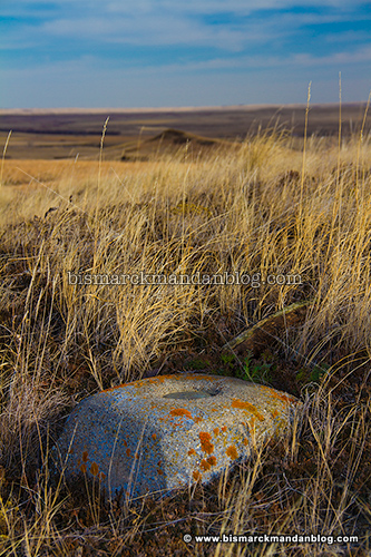
This is a marker from the
US Geodetic Survey. You can find out more about what this means and the project’s history by
clicking here for its website. These markers are an important part of our nation’s first detailed mapping of its terrain. The odds of me stepping on one of these are infinitesimal, so I was particularly pleased with the find.
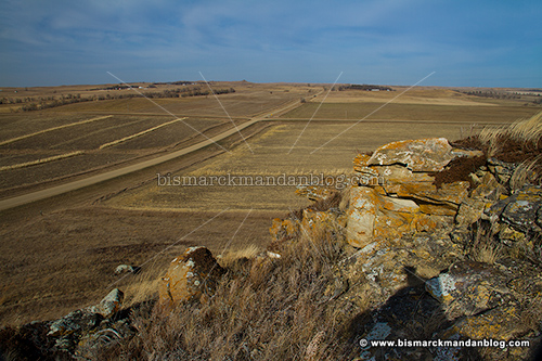
Once again I’d like to state that, as always, I had explicit permission to be here on that day… and that this land is now occupied by cattle. Please use these photos to enjoy its remarkable features. There are some other interesting and photogenic subjects nearby, but I think I’ll leave them for a future post or posts!