It could be a while before your next Fort Lincoln Trolley ride

Hiking north of Fort Lincoln reveals trouble for the Fort Lincoln Trolley, one of my favorite local attractions. Most people haven’t seen even a small fraction of the devastation caused by the Flood of 2011 south of Mandan, and this is just one of many tragic stories.

This particular section has left a long stretch of rail, along with whatever ties were strong enough to remain attached, literally hanging in open air.

While the rails have not broken, they’ve certainly bent and are in serious need of rescue. The dark spot to the right of the tracks in the upper right portion of this photo is an enormous crack in the earth.

This isn’t the first time that the trolley folks have had to deal with erosion of the hills upon which their track resides; however, I don’t know whether previous damage was anywhere near as serious as this. Not only has a lot of the hill let go, but there are still major cracks in parts of the hill that remain. It looks as though plenty more dirt is waiting for an opportune moment to plunge toward the river as well.

As you can see, a large section of the hill simply separated and tumbled toward the river below as the hill was eroded from its base by the overflowing river. I used my monopod as a makeshift jib to suspend my camera in the air over the tracks for this treacherous shot.

I don’t know what it’ll take to get these tracks back to operational status; it looks like a trellis system might be required, because I don’t think it’s feasible to try to rebuild and reinforce this section of the hill. Hopefully something can be done for next season, because this trolley ride is one of the more fun ways to spend a summer afternoon! I shot some video of my last ride…I’ll have to put a little something together and post it here.

I’m sure glad the rumormongers didn’t get a hold of this

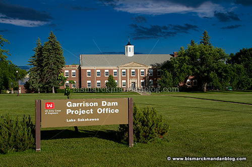
The last twelve months haven’t been exactly stellar for the Army Corps of Engineers. They’ve been far worse for thousands of people who’ve had to deal with the results of their pooch-screw policies in regard to management of the Missouri River System. Their lack of credibility with people in the Dakotas was validated when the Argus Leader newspaper uncovered emails with bombshells such as Todd Lundquist’s quote saying, “I’m headed home. I no longer look people in the eye and tell them the forecast is 85,000 cfs from Garrison.” Later releases would reach nearly double that rate. While there was a lot of rumbling and grumbling going on, I stumbled upon a another sort of rumble:

I was surprised to find this event on the USGS earthquake watch website, an 3.5 magnitude quake west of Fort Peck which hit on July 1st. This was a day or so before an oil pipeline burst beneath the Yellowstone River far away near Billings, an event which grabbed all the headlines for a few days. While I don’t think this quake was directly related to the spill, I remember seeing some other quakes much closer to the pipeline leak at the time. What was interesting was that nobody spotted the 3.5 shaker and either tried to connect it to the pipeline failure or use it to sensationalize the possibility of a failure at Fort Peck.


Remember, this was about a month after environmental activist Bernard Shanks published a guest commentary on the St. Louis Today website outlining his fear of a “domino effect” on the Missouri River System. His nightmare scenario began with the failure of the Fort Peck Dam. While his article was very timely, it also coincided with one other important event: his publishing a book on the theory. I doubt that was a coincidence, but the whole thing gained a lot of traction in the Dakotas as we were already learning not to trust the Corps. Mr. Shanks appeared on local radio and links to his article were flying around Facebook rather furiously.

Then, of course, you have to wonder about this: an emergency bid being put out for the material which reinforces the Fort Peck Dam, the very one Mr. Shanks claims is the weak link and which was at 111% of capacity.

Naturally the last thing I wanted to do was contribute to any hype, so I just sat on my little discovery. I don’t deal in sensationalism and reliable information was already hard to come by in weary communities already made nervous by the fluidity of facts. Therefore I resolved to wait until the flood waters had receded and the threat of Mr. Shanks’ domino effect abated with them. I’ve watched as the river levels have fallen past the 9.79 feet of January 1st, 2011 and settled in the six-and-a-half foot range. While I think the event is certainly noteworthy, I certainly don’t think it was worth hysteria.

Here are a couple of links to the event for the curious. Its ID is event 11948206 for those of you who want to dart straight to Google for your own research.

USGS Earthquake event website entry

USGS Shakemap web page for #11948206

Now let’s hope that the management of the Missour River System doesn’t put us in the same precarious position next year. In the unfortunate event that we find ourselves in a flood fight again, I hope the Corps will be more forthcoming and that people will resist the urge to play loose & fast with information. Events like this are far harder to endure when sensationalism runs amok as well.

Watermark revisited

Here’s another angle at the historic Northern Pacific bridge along our receding Missouri River. This has been one of my favorite indicators of the river’s rise and decline.

As you can see, that’s a pretty tall watermark. The river is currently at under seven feet, after a height of approximately twenty. I don’t know how much longer this watermark will remain, but for now it’s a stark reminder of how the Big Muddy behaved in 2011.

A tale of two ditches, revisited

Three months ago I visited Double Ditch to assess the impact of Missouri River flooding on the view. It was astounding; any trace of sandbars had vanished beneath a wide expanse of water. Now that access to the site is no longer prohibited, I was a little curious about what it looked like:

As you can see, we now have plenty of sandbar. In fact, there are plenty of other places along the Missouri that now have plenty of sand. Welcome to the new normal!

One other thing that’s noteworthy, and hard to discern from these photos because they’re framed so differently, is how much farther south the sun sets in mid-September compared to June. On the longest day of the year, just four days after the top photo was taken, the sun sets much farther north. As winter creeps closer and the days grow shorter, however, the sun’s track moves southward and peaks lower in the southern sky during midday. It may be interesting to return to Double Ditch on the shortest day of the year and see where it intersects the horizon; if I do so, you’ll see it here.

You spell it Hogue, I spell it Hoge…let’s call the whole thing off

So I’ve been politely poking fun at KFYR-TV and others like my friend Mark who keep referring to “Hogue Island” online. I’ve always known the Hoge Island Boat Landing, the Hoge Field model aircraft club, and the like…so where did the U come from?

Bringing this up to Mark, he told me to “read the signs!” Always willing to double check myself, I decided to take the long way home after work and investigate. Guess what: Hoge. Look above and see for yourself. Case closed, right? Nope.

It looks like these signs have been corrected to indicate “Hoge Island” but did originally say “Hogue”. You can see from this photo where the “ue” has been covered and replaced with an “e” to alter the spelling. Did the makers of the original sign make the same “error” that Mark and others have made? Not quite…it appears there may be some actual contention on the spelling.

I was hoping that it might be as simple as looking for a Hoge Township on the Burleigh County map (PDF), but sadly that did not yield the intended result. Burleigh County itself refers to the area as Hoge Island. So how do I try to get an authoritative, definitive answer?

Well, while I’ve actually been wondering about this since late May or early June, it turns out that the Bismarck Tribune has been on top of it. They did this story on the matter back in June and discovered that two branches of the family which once owned the land in the area spelled their last name in two different ways. So we’re BOTH right. Thanks to Chris Bjorke for the legwork on this one.

I knew a guy in college whose last name is Hoag. I wonder if he’d want to chime in on the matter

Cutting to the corps of the issue… with lots of web links, as usual

The Army Corps of Engineers has some tough questions to answer. I don’t envy them. A recent investigation is turning up some very interesting emails regarding the Missouri River flood situation.

The most notable passage I’ve read so far is where Todd Lindquist writes, “I’m headed home. I no longer look people in the eye and tell them the forecast is 85,000 cfs from Garrison.” As it turns out, releases would eventually exceed that number by another 70,000 cfs… a fact North Dakota would be told only gradually.

There have been plenty of people making the case that the river was horribly mismanaged prior to the flood event. I wouldn’t argue with that. Now it’s time to figure out where everything went sideways and to prevent it from happening again.

In a way, I have a lot of sympathy for the Corps of Engineers; after all, they have strict guidelines to which they must adhere, guidelines which result in quite a juggling act as they struggle to make many competing interests happy. That’s quite an unenviable position.

Any investigation and resulting action that is taken in the aftermath of the Missouri River flood needs to be more than a simple headhunt. It also needs to take a long, hard look at the way the Missouri river system master management manual is written. Perhaps the dams should be returned to their original intended purpose: flood control. That way when barge traffic, recreation, and an endangered bird begin to cause mismanagement of the system, people’s lives and property don’t become casualties of the resulting mess.

Watermark

No, I’m not talking about the Enya album. I’m actually talking about indications of how high the river level has been. One of the best ways for someone who doesn’t live in a flood-affected area to get a handle on the water level is to find a familiar place which can give you a good point of reference. For many, including myself, Pioneer Park is one of those places. If you look at the photo above, you can tell that the water level has dropped significantly.

Picnic tables that were bobbing in the water before are protruding from the water quite nicely now.

The only thing monumental about these things is the the waste of tax money to produce them. In any case, there’s a good reference point here as well. A clear high water mark can be seen and the water was up to the signage at one point as well.

That’s not all: the pilings for the NP railroad bridge have a tale to tell as well. Note the turbulence along the side of the pillar. I’ve got some amazing photos and videos of that from earlier in the flood event, I just haven’t had time to share them…yet.

Even at good ol’ Fort Lincoln, there are signs of receding water. In addition to the birds-eye view of the flood from the top of the northeast blockhouse, there’s also this little slice of backwater.

Once again, the structure gives a good indication of water finally receding. There’s a beaver that hangs out in this little inlet who I think has been enjoying the high water levels and is in for some disappointment! A couple of weeks ago I watched him slap his tail as he swam back and forth.

With releases from the Garrison Dam continuing to diminish, I’m sure we’ll begin to see a major difference. I notice that the river gauge in Bismarck indicated 23.67 feet earlier today, but that’s obviously a glitch. Hopefully we’ll start a steady decline toward normal river levels soon!

This seat taken

This would appear to be a front-row seat to the Missouri River flooding. There’s only one problem: even though I took this photo a few short days ago, I believe this bench is now completely underwater along with the parking lot behind it!

Great minds think alike, and so do ours

The other day I hopped on one of my motorcycles for a short ride, and I happened upon the area near the Grant Marsh Bridge. There were a few photogenic things to capture in the area, and a motorcycle doesn’t take up much space, so I was able to pull over briefly without interrupting traffic on River Road or crossing any barricades.

This keelboat seems to have been built in just the right spot for a 500-year flood event. The water comes right up to it, but even at such record levels it doesn’t actually flood out the boat. It’s almost as if it was designed for a day like today.

Even the walkway is dry, despite flooded land all around. Too bad the area is blocked off, this would actually be a nice little tourist-y spot for all the gapers that have been driving 20 miles an hour up and down River Road for the past few weeks!

Here’s a good vantage point for the flood, if you’ve got waders on…or perhaps clothing and shoes you don’t mind getting wet. Which reminds me, my buddy and former coworker Mark Armstrong got the same idea I did, because I saw him there just after I went north to Pioneer Park and turned around to head back south into town. He was busy with his camcorder, so I didn’t stop to interrupt. Here’s the video he was shooting:

Great minds think alike…and so do ours!

Pioneer Water Park, plus a quick profile

One of the most dramatic and accessible (sorta) sites for local residents to gauge the impact of the Missouri River flooding has got to be Pioneer Park. It’s easy to get a point of reference as far as how high the water is, it’s right along the road, and it’s a feature that most residents have probably seen quite often before and since the flooding began.

Picnic tables have been relocated as they’ve become somewhat bouyant, getting hung up on other park features. The volleyball nets look more like tennis nets right now, and who knows what the sand in the courts will look like when the water recedes?

Don’t forget to call and make your reservation! Actually, I think the mosquitoes have this place booked solid for the next couple of months. It’s actually a CLOUD of bugs down there right now, and I’ve got the bites to prove it. In addition to water damage, Bismarck-Mandan is going to have a lot of insect control to perform with all this water. Those plans have already begun.

The state Water Commission has released a recent river profile and it has some very interesting results. Some areas have been dug deeper, some have been filled in, and overall the river is, as I’ve heard it described, “active.” Just what the Missouri River looks like, including the channel, banks, and sandbars (or lack thereof), will be very interesting once the waters recede. I don’t know of anyone making any solid predictions on that right now.

Let’s just hope we get through this without further loss of property and that we can begin the recovery process. Minot has it even worse than we do, but one remarkable statistic throughout all of this North Dakota flooding is that we have not lost one single life to the disaster. That’s got to be the best news so far.